For Japan and specially for Tokyo there are a lot of map and commute apps and because there are so many it might be hard to decide which one to download and to know if they work offline or not. I will be talking about some online maps as well, because the answer to the question “is there a best app to use? “Is yes and no. It should not come as a surprise that basically the best app is Google maps but, it is an online map which makes it bit of a hassel if you don't have internet or simply don't want to use your mobile data. There are other apps with useful information and useful features that Google maps does not have some of these are offline maps, others are just partly online. With this article, I am going to go through the best apps to use with some of them only needing internet partially, I will also explain how to make the best out of offline maps, because there is not just one offline app that can do the trick alone.
A good tip to know while traveling
Most of the apps need internet connection to work, basic gps tracking without internet connection won’t work. Some of these apps have offline features as well, which helps for those who do not want to stay connected to the internet cause it can be quite expensive for a traveler. I will also talk a bit about how to best get around without using any internet connection, but for now let’s start by going into the best offline map apps that you can use to travel.
Google maps
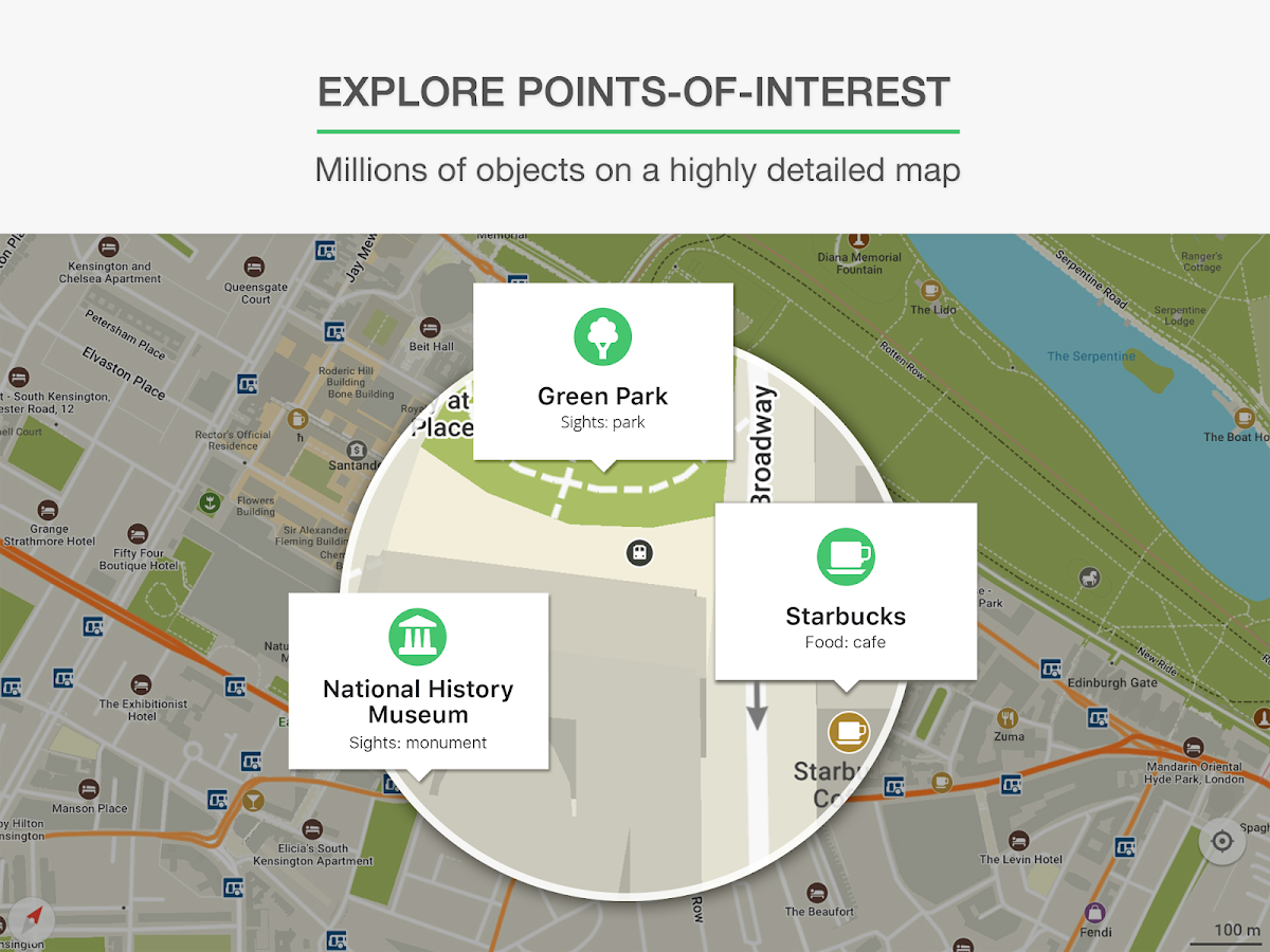
As I said in the beginning, the google maps is maybe the best app to actually get where you want and in the fastest way, the problem with google maps in japan is that you need to be connected to the internet to use it. You cannot even download the offline map of Japan and use that, but the good things about google maps when you have internet are, it will show you all the possible ways to get from point A to point B and it will show you even how long it takes and how much it costs. The google maps is most precise, it gives you the best information and shows you of course your surrounding area and what you can find from there. If you want the best, most precise information and you are able to use internet then Google maps should be your first choice.

Image courtesy of Google play
Price: Free
Available for: iPhone, iPad, iPod touch, Android and computers.
Maps.me and Citymaps2go
Both of these maps can be used online and offline, they will show you the “things close to you “ if you have downloaded the map of the area before. These apps are also useful to find out where is the closest wifi spot that you can use. The nice feature in both of these apps is that you can find things by categories, for example restaurants, bars or sightseeing spots. The problems with these apps is that neither of them has any kind of information about public transportation. Maps.me can show you offline how to get from place to place by Walking, car, bike or help you order a taxi to your location. Citymap2go unfortunately does not show you “how to get there” it just shows your current location and the location of the place you want to go to. These are very good apps to find smaller interesting places and places you can get to by walking.
Maps.me
Images courtesy of Google play
Price: free
Available for: iPhone, iPad, iPod touch and Android.
Citymaps2go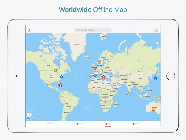
mages courtesy of App store
price: Free
Available for: iPhone, iPad, iPod touch and Android.
Navitime for Japan Travel
This app has many features in it but unfortunately if you are not willing to pay for it, it will lose to google maps in its usefulness, just like google maps it needs internet connection. One of the huge downsides to it compared to google maps is that the free version won’t show you the route you are going to travel through to your destination it will show only which station to get on and where to get off but not the location of the station itself. It has bit more of information about things happening in Japan,tourist attraction and other places, but again to read these you need to be connected to the internet, so basically you could just google them if using google maps.

Images courtesy of Google play
Price: free (lite) Full version: 7 days = 700 yen and 30 days = 1500 yen
Available for: iPhone, iPad, iPod touch and Android.
How to travel the best way without internet?
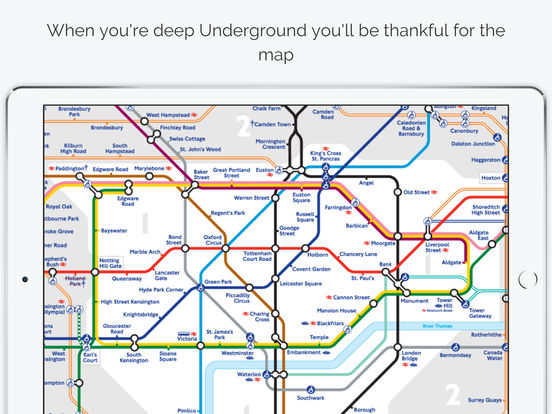
If you do not want to use internet to get where you need to go there is no one app that helps you with that, but using couple of aps together will pretty much do the job. So, the first App you should have for this is the Maps.me app, then the other apps you need are the metro and railway apps of the city. Most big cities in Japan have offline metro and train app that you can use to find how to get from one station to another, the time it takes and some of these even have the info of how much it costs. So, with map.me you can find how to get to the station you need to go to and with the metro app you can find how to get to your destination.
Here are the metro and train apps for Tokyo
Metro
Images courtesy of Google play
price: Free
Available for: iPhone, iPad, iPod touch and Android
Train

price: free (online-use only) or 500yen (can be used offline)
Available for: iPhone, iPad, iPod touch and Android